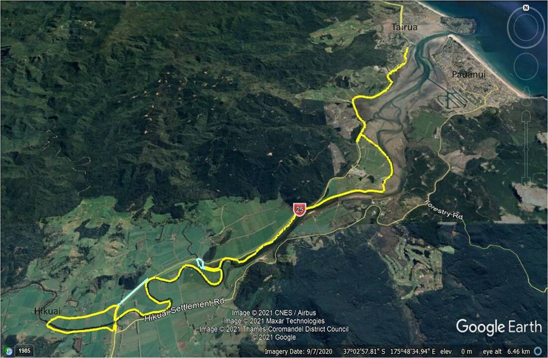
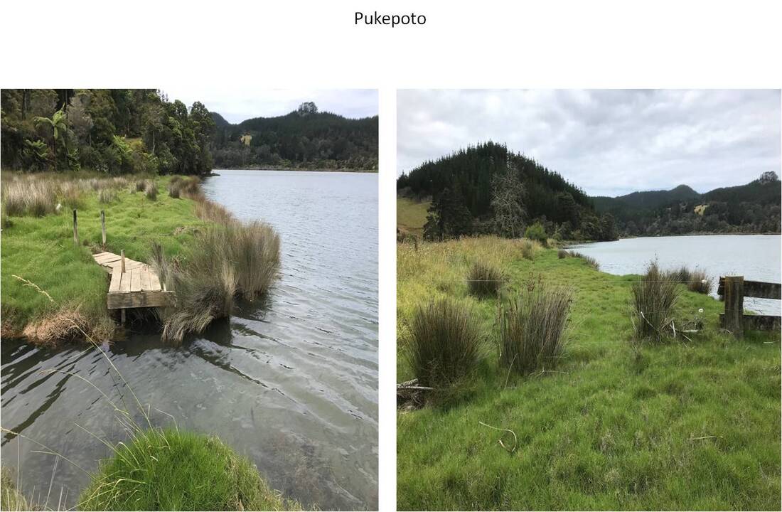
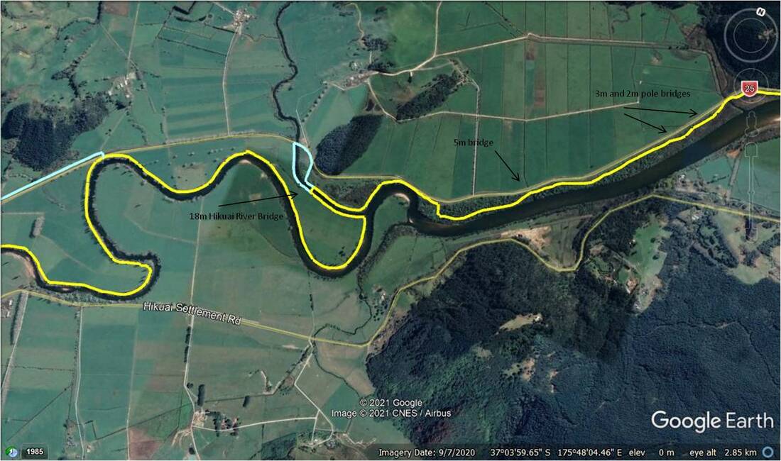
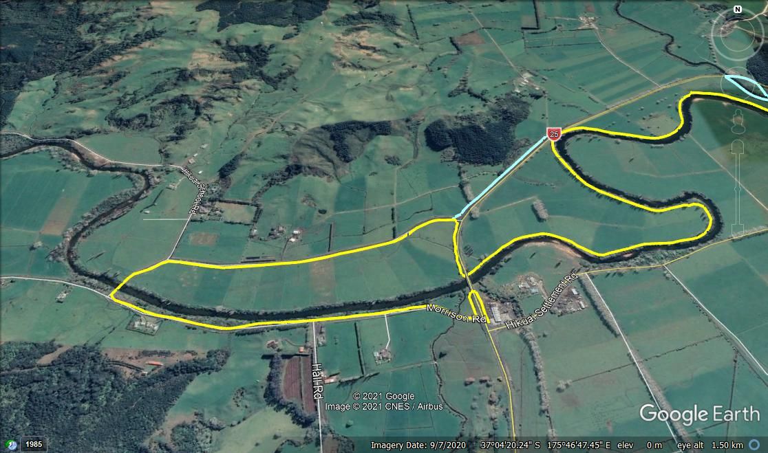
This page shows the proposed route of the trail along the northern bank of the Tairua river from Tairua through to Hikuai. The proposed route shown in the maps below is indicative only and will be further refined after consultation with all stakeholders and other affected parties and after survey, where required. The trail alignment will be designed to be as far away from SH25A as and where possible to keep cyclists, walkers, runners safely away from a very busy highway. When the trail crosses the river at Hikuai, the loop to Pauanui will be complete and options to access the Puketui Valley and also traverse the Coromandel ranges to join other great trails will be facilitated.
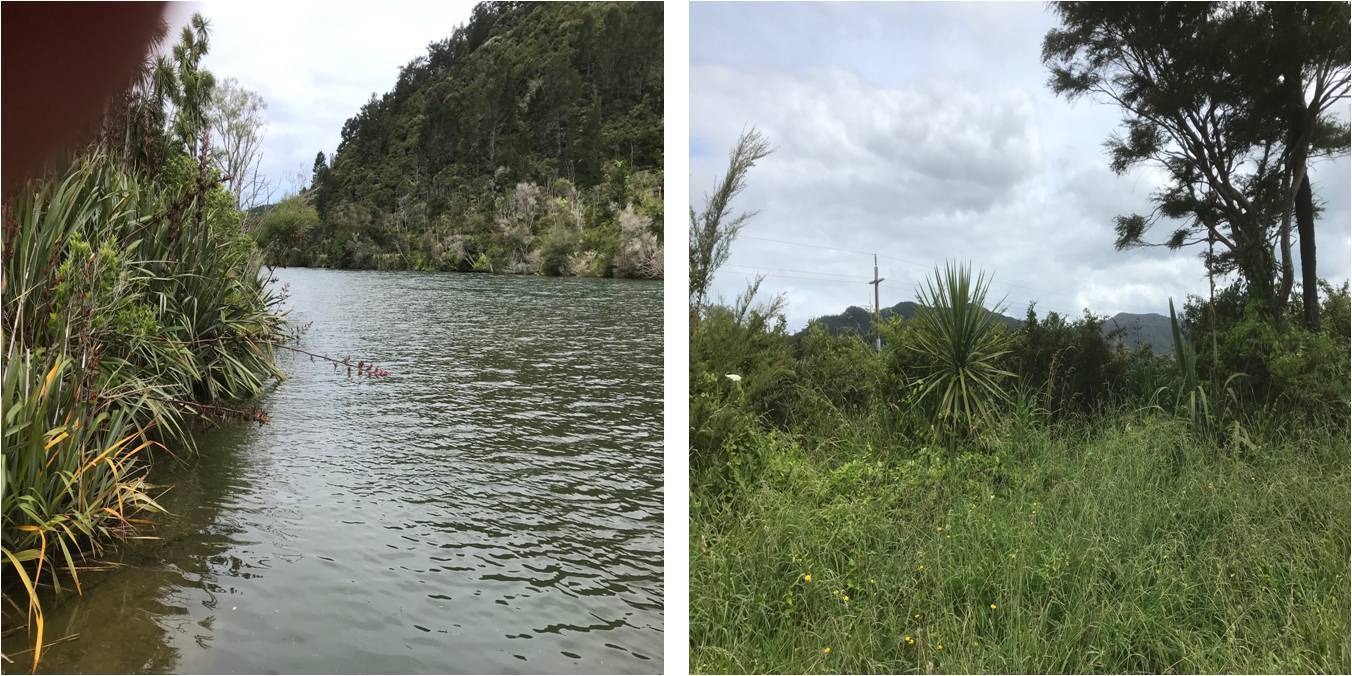
The proposed trail follows the river wherever possible which means it will provide stunning views of the natural beauty of the inlet and beyond. As the trail is constructed, ongoing enhancement to the environment through fencing, plantings and pest control will be carried out to provide a further asset to be enjoyed by the community at large.
The overall trail route is shown below and then further broken down by segment to provide more detail.
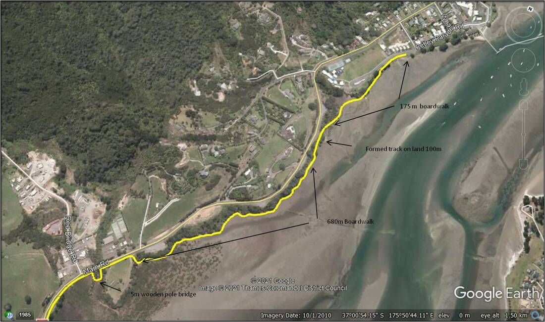
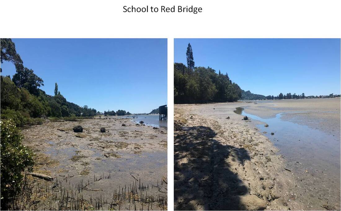
1. Tairua School to Red Bridge Road - a challenging section of the trail largely over the water in the estuarine Coastal Marine Area. Various construction choices are being evaluated such as timber, concrete or grid boardwalk or floating pontoons. This section will be a spectacular entrance to the trail from Tairua providing extensive harbour views at sea level and an experience completely immersed in nature.
This area also embraces some interesting historical references of great significance which draw attention to the past history of the region currently unavailable to public.
It will also provide a very important pedestrian access for Tairua locals to visit the RSA cemetery and for an expanding residential area west of town the facility to walk to Tairua (and Tairua school) in safety. Pedestrian and cycle access to the Red Bridge road area creates further opportunities to link established trails winding back to Tairua via the track through to Hinemoa Terrace and a future link to the existing Pepe loop track. This creates sensational linked trails that may be used often by the local rugby, surf and other clubs for fitness training.
2. Red Bridge Road to Green Point - from beyond Red Bridge road towards the old sawmill site, the route will follow mainly even terrain close to the highway. There is a small bridge to cross the stream immediately upon exiting the cemetery area. The trail will be located in bush vegetation closely following the road alignment.
When the trail meets Red Point, a stunning rocky outcrop is safely bypassed on the river side to provide great views. The trail then follows the bush line for 250 metres when it will then descend to the foreshore for a further 500 metres. Returning to the bush beside the road the route offers views over saltmarsh where power lines cross the estuary. There may be need for a boardwalk away from the road just prior to crossing Oturu stream where a 12 metre bridge will be required with a favoured option to “clip on” to the existing NZTA bridge structure. The trail then follows the road alignment to the area around Green Point. There are some alternates to navigating this area, with currently a verbal agreement with resident iwi that cultural values and views will be respected in the final alignment of the Trail.
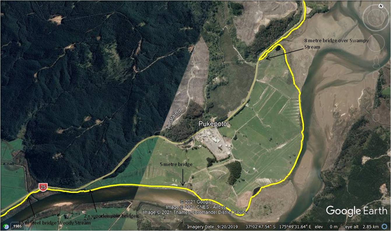
3. Green Point towards the Cabbage Tree area - after rounding Green Point the trail reverts to the foreshore for 550 metres to Swampy Stream. Alternate crossing locations of this stream are being evaluated but this will require an 8 metre bridge. From Swampy Stream the trail follows the marginal strip back towards Tairua river. This section provides spectacular views of the river and the Trail on the southern side will be visible across the water. The Trail follows the foreshore past a small pond and another 5 metre bridge will be required to cross established drains. Although the trail will be aligned in public land, careful and considerate consultation will be undertaken with input from the adjacent private property owners in this area. The Trail will then follow the riverbank for approximately 700 metres to an area where a series of small pole bridges will be used to traverse 3 cross drains. Departing from the river front the Trail then climbs into bush to utilise an old disused track near the highway. Exiting the bush close to the road to the Cabbage Tree area of Woody Stream. A 15 metre bridge will be required over Woody Stream before it then enters the iconic Hikuai Ti Kouka Grove.
4. Cabbage Tree area to Hikuai River Bridge - the Hikuai Ti Kouka Grove (Hikuai means tail of the river, and Ti Kouka is Te Reo for Cabbage Tree) provides a stunning outlook and a truly memorable section of the Trail. A 3 metre bridge will be required after 200 metres after entry to the plantation. Winding through spectacular flora ,fauna and native trees, this area is largely free from flooding and provides an outlook of native bush and the river with excellent bank stability and very little erosion. After 1.5 kms of spectacular bush, the Trail exits near to the highway following the bend in the river on an already reinforced embankment. The Trail then follows bush to where it will meet the Hikuai river where a crossing will be required. It is hoped this crossing can be achieved in conjunction with the current planned redevelopment of the existing Bailey bridge by NZTA. Having crossed the river, the Trail will traverse the isthmus of farmland and then once again follow the river.
5. Hikuai Junction - The preferred Trail following the bank of the river may not be available and ongoing alternatives are still being considered in this area. Issues with existing river erosion of public land means alternatives need consideration with a potential route close to SH25A as one such option. Discussions need to be had with affected parties to achieve the best result for all concerned. The options will all converge close to the existing underpass which with discussion may be used to cross under SH25A instead of crossing the road. Safety for Trail users and landowner consideration are foremost in mind before finalising this section of the Trail route. The Trail is then planned to follow Morrisons Road which means it will pass close by Hikuai School perhaps offering pupils a truly epic commuting option! After crossing the old Hikuai bridge, where amazing views of the Pinnacles are to be had, the Trail then returns along Morrisons Road on the southern side to meet the existing SH25A underpass. The opportunity for a refreshment stop at the Prescott's garage area will be welcome.
